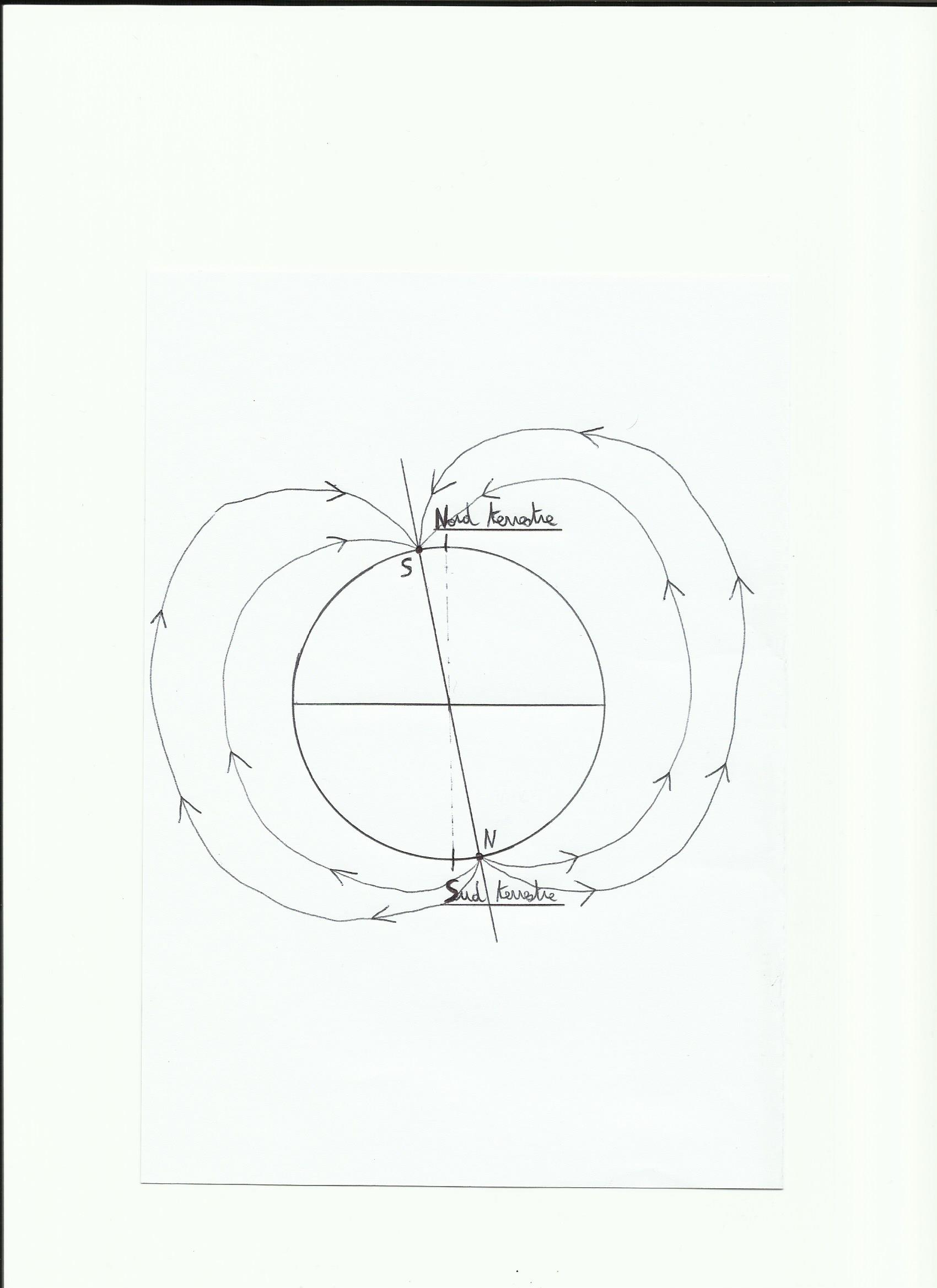
Like almost all celestial bodies the earth develops a magnetic field due to its rotation on itself. This field depends on the amount of iron present in the core, iron masses present on the surface and rotation speed(neutron stars, pulsars have a very strong magnetic field because their speed is very important). This magnetic field is materialized with the presence of the magnetosphere, this is a field line which is running around the earth and protects it from sun particles.
The magnetosphere is self-sustaining like a dynamo effect:
.Earth's magnetic field acts as a magnet, an inductor(equivalent of the electromagnet in a car alternator).
.The mass of liquid iron in rotation in the core acts as the coil of conductive copper, so the armature(it is the stator in an alternator car).
The Earth's magnetic field is organized as a conventional dipole magnet with a north and south pole, the field lines emerge from the north pole and enter the south pole; So in fact what is currently shown as the North Pole by the compass is actually the South Magnetic Pole.
1)Earth's magnetic field
Important fact for navigators, the magnetic poles line is shifted from the geographic poles line currently about 8 °.
Magnetic North is located approximately 82 ° N latitude and 11 ° W longitude(corresponds to the northern Canadian coast). Magnetic South is at 65 ° S latitude and 138 ° E longitude roughly.
This magnetic poles line is variable in time, and is able to travel the globe to reverse on a period(there may be up to 5 reversal of poles on 1 million years, an inversion lasts about 15000 years).
2)noticeable effects
On charts we meet this kind of thing:
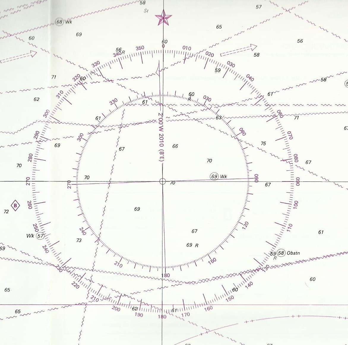
This tool simply points out the difference between true north which is the geographic North (where meridians intersect), and magnetic north. In the circle's center you can see a vertical inscription: “2°00W 2010(8'E)”. This means that in 2010 Magnetic North was(in the chart's area)shifted 2 ° W to True North. “8'E” means that every year the magnetic north moves to east 8 minutes, So every year the magnetic north is closer to the True North. So in 2014, known 1 ° = 60 minutes, this difference will be 8 * 4 = 32′ in fact about 1/2 degree of difference from 2010. In 2014 North Magnetic North difference true / will be 1 ° 28'W. This difference is the Declination.
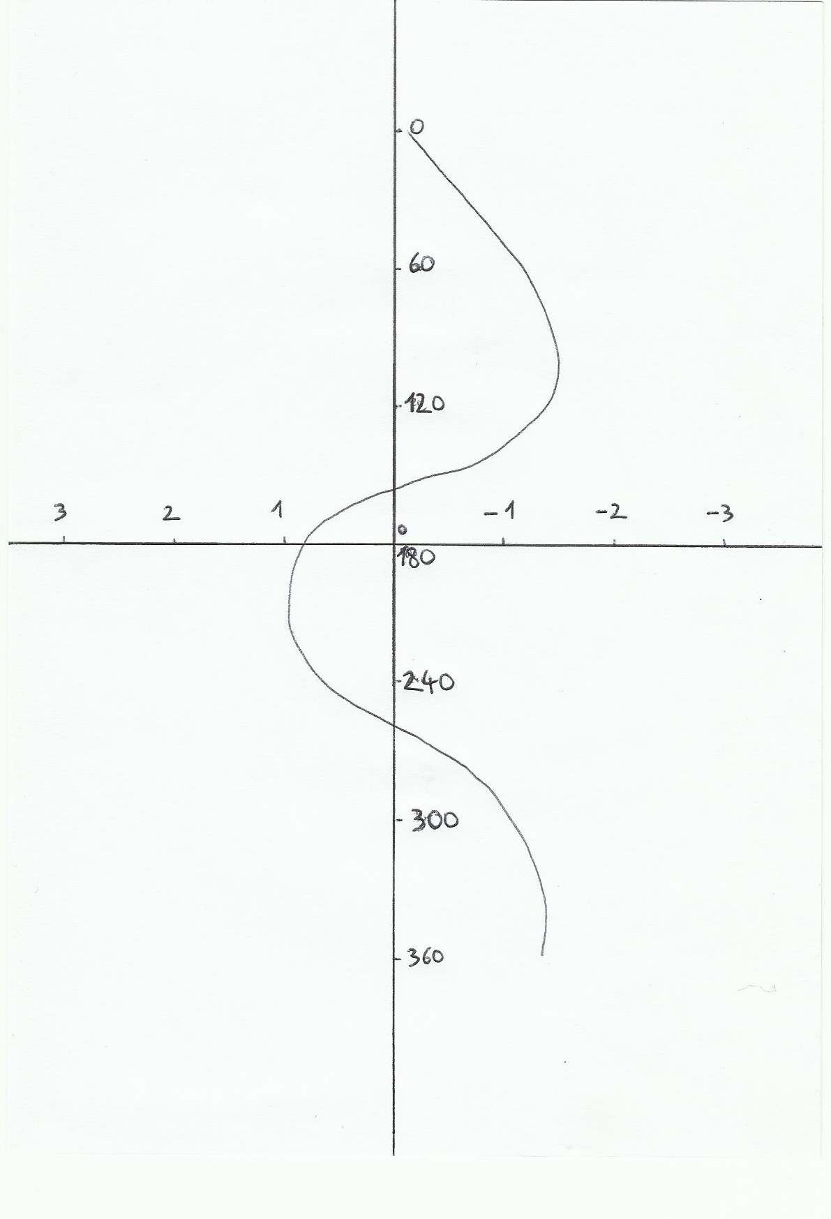
However, otherwise it would be too simple, we must add an another parameter, the possible magnetic interferences met on a boat. The presence of metals or electrical circuits near the steering compass or hand bearing compass can affect him. In fact the magnetic north is not always equivalent to the North compass( read on the instrument). This difference is called the deviation. On a boat we materialize it through a deviation curve which shows the differences between the magnetic heading that we should find and the compass heading read. We can draw this curve at the port by turning the boat in all directions and writting the differences with an another compass on the quay, or with the help of a gps during a navigation, or using the steering ranges too.
Finally, between true heading(that made by the boat)and the compass heading indicated by the instrument, we must take into account deviation and Declination. We can combine them in the variation W. W(variation)=D(Declination)+d(deviation)
The true heading drawn on the chart is the compass heading combined with variation. On the contrary, when we start from the chart, to give a right direction to the helmsman this variation is substracted. Cv(true heading)=Cc(compass heading)+ W.
Declination as the deviation is negative when it is West and positive when it's East.
The magnetic field is also on the origin of borealis auroras at the poles(the solar wind particles act with atmosphere's atoms, creating luminous phenomena)and magnetic storms(sudden changes in the Earth's magnetic field during solar storms).
Notice: the deviation is very important for metal boats. In general for coastal navigation trips it can be underrated, However, offshore it is essential for the dead reckoning as Declination.
La courbe de déviation est curieuse car la valeur n’est pas la même à 360 ° et à 0° …
Oui en effet, la valeur trouvée devrait être la même en réalité si on fait une courbe de déviation sur un bateau, après ici c’est juste une courbe tracée pour illustrer le principe.